![](/images/other/stat-length.png)
![Excursión Senderismo Cans et Cévennes - Stevenson 05 Mijavols - Florac - Photo](https://media.geolcdn.com/t/1900/400/ext.pjpeg?maxdim=2&url=https%3A%2F%2Fstatic1.geolcdn.com%2Fsiteimages%2Fupload%2Ffiles%2F1553511878bg_sport_marche.png)
Stevenson 05 Mijavols - Florac
motardes04
Usuario
![Longitud](/images/other/stat-length.png)
![Altitud máxima](https://static1.geolcdn.com/siteimages/upload/files/1508320355ic_sort_altitude_max_24dp.png)
![Desnivel positivo](https://static1.geolcdn.com/siteimages/upload/files/1508320355ic_sort_den_pos_24dp.png)
![Km-Effort](/images/other/stat-length.png)
![Altitud mínima](https://static1.geolcdn.com/siteimages/upload/files/1508320355ic_sort_altitude_min_24dp.png)
![Desnivel negativo](https://static1.geolcdn.com/siteimages/upload/files/1508320355ic_sort_den_neg_24dp.png)
![Boucle](https://static1.geolcdn.com/siteimages/upload/files/16400158638029165_repeat_loop_refresh_sync_direction_icon.png)
![Senderismo](https://static1.geolcdn.com/sitytour/trail-icons/101.png)
5h55
Dificultad : Muy fácil
![Escanee este código QR para abrir la excursión en la aplicación SityTrail](https://capi.geolives.com/qq0zvz2zws4bq2lad0pu/sitytour/trails/462028/qr.png?size=200)
Aplicación GPS de excursión GRATIS
A propósito
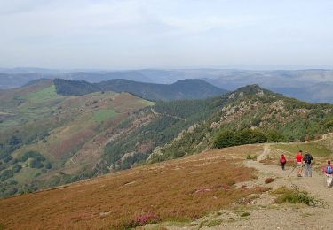
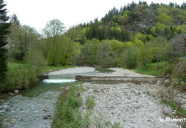
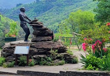
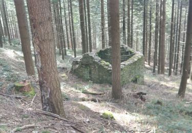
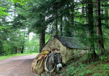
Ruta Senderismo de 16 km a descubrir en Occitania, Lozère, Cans et Cévennes. Esta ruta ha sido propuesta por motardes04.
Descripción
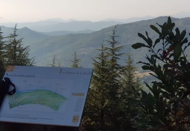
On a triché ... On a quitté le GR70 pour éviter de descendre à Bédouès et de faire des km sur le bitume. Du coup l'étape était plus courte.
Temps Marie : 5h55
Temps Sitytrail : 4h28
Topo par le GR70 :16 km (hors Mijavols mais via Bédouès) et 4h15
Localización
Comentarios
Excursiones cerca
![Excursión Senderismo Cassagnas - E10 Cassagnas - Lebou GR70 - Photo](https://media.geolcdn.com/t/375/260/57dc1f2d-251c-4790-9935-92bcfdd604c8.jpg&format=jpg&maxdim=2)
![Senderismo Senderismo](https://static1.geolcdn.com/sitytour/trail-icons/101.png)
Senderismo
![](/images/other/stat-length.png)
![](https://static1.geolcdn.com/siteimages/upload/files/16400158638029165_repeat_loop_refresh_sync_direction_icon.png)
![Excursión Senderismo Cassagnas - Etape 9 Cassagnas/St Étienne Vallée Française - Photo](https://media.geolcdn.com/t/375/260/5116013d-c6b9-443f-8dc6-fbf0a17c62f0.jpg&format=jpg&maxdim=2)
![Senderismo Senderismo](https://static1.geolcdn.com/sitytour/trail-icons/101.png)
Senderismo
![](/images/other/stat-length.png)
![](https://static1.geolcdn.com/siteimages/upload/files/16400158638029165_repeat_loop_refresh_sync_direction_icon.png)
![Excursión Senderismo Cans et Cévennes - Calberte - Photo](https://media.geolcdn.com/t/375/260/d777e7b7-e262-4b91-abe1-d143cbd79633.jpg&format=jpg&maxdim=2)
![Senderismo Senderismo](https://static1.geolcdn.com/sitytour/trail-icons/101.png)
Senderismo
![](/images/other/stat-length.png)
![](https://static1.geolcdn.com/siteimages/upload/files/16400158638029165_repeat_loop_refresh_sync_direction_icon.png)
![Senderismo Senderismo](https://static1.geolcdn.com/sitytour/trail-icons/101.png)
Senderismo
![](/images/other/stat-length.png)
![](https://static1.geolcdn.com/siteimages/upload/files/16400158638029165_repeat_loop_refresh_sync_direction_icon.png)
![Excursión Senderismo Cassagnas - Le Plan de Fontmort par Magistravols - Cassagnas - Photo](https://media.geolcdn.com/t/375/260/ext.jpg?maxdim=2&url=https%3A%2F%2Fservices.sitytrail.com%2FGeolivesWS%2FDownloadMedia.ashx%3FTrailID%3D129856%26Media%3D13415_6.jpg)
![Senderismo Senderismo](https://static1.geolcdn.com/sitytour/trail-icons/101.png)
Senderismo
![](/images/other/stat-length.png)
![](https://static1.geolcdn.com/siteimages/upload/files/16400158638029165_repeat_loop_refresh_sync_direction_icon.png)
![Excursión Senderismo Cassagnas - Stevenson Cassagnas - Pont de Burgen - Photo](https://media.geolcdn.com/t/375/260/bc1cdb36-8d76-4efa-b768-4718d5abde5d.jpg&format=jpg&maxdim=2)
![Senderismo Senderismo](https://static1.geolcdn.com/sitytour/trail-icons/101.png)
Senderismo
![](/images/other/stat-length.png)
![](https://static1.geolcdn.com/siteimages/upload/files/16400158638029165_repeat_loop_refresh_sync_direction_icon.png)
![Excursión Senderismo Cans et Cévennes - Le Mazel de Mort - Photo](https://media.geolcdn.com/t/375/260/f9ad57d9-32ab-4969-8d93-23cd2f2787c9.jpg&format=jpg&maxdim=2)
![Senderismo Senderismo](https://static1.geolcdn.com/sitytour/trail-icons/101.png)
Senderismo
![](/images/other/stat-length.png)
![](https://static1.geolcdn.com/siteimages/upload/files/16400158638029165_repeat_loop_refresh_sync_direction_icon.png)
![Excursión Senderismo Florac Trois Rivières - 2021 STEVENSON Étape 5 - Photo](https://media.geolcdn.com/t/375/260/55754c50-cd86-44dc-9834-15a69ee526fc.jpg&format=jpg&maxdim=2)
![Senderismo Senderismo](https://static1.geolcdn.com/sitytour/trail-icons/101.png)
Senderismo
![](/images/other/stat-length.png)
![](https://static1.geolcdn.com/siteimages/upload/files/16400158638029165_repeat_loop_refresh_sync_direction_icon.png)
![Excursión Senderismo Cassagnas - Cassagnas - Saint germain - Photo](https://media.geolcdn.com/t/375/260/55ddb16f-d524-4860-95ff-ecfdd4f2198a.jpg&format=jpg&maxdim=2)
![Senderismo Senderismo](https://static1.geolcdn.com/sitytour/trail-icons/101.png)
Senderismo
![](/images/other/stat-length.png)
![](https://static1.geolcdn.com/siteimages/upload/files/16400158638029165_repeat_loop_refresh_sync_direction_icon.png)